Ruvuma
The far south-west: Ngoni country and the memory of the Maji Maji war, Matengo coffee grown in hand-dug pits, the country's largest coal mine, and a shore of Lake Nyasa almost no visitor reaches.
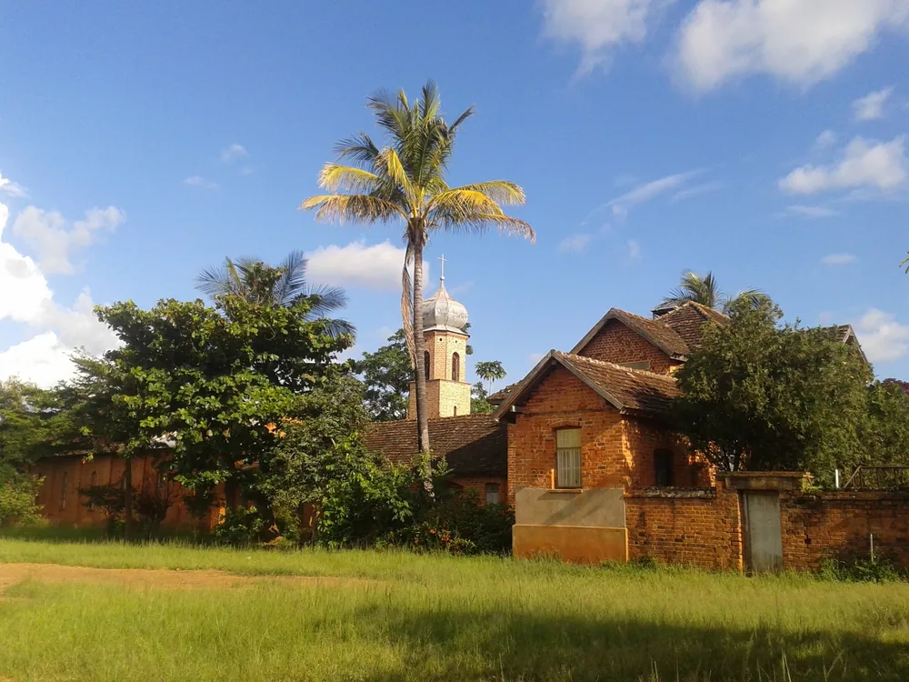
The Catholic mission at Mahanje. Missions have been a central institution in this region since the 1890s.
- Region
- Ruvuma Region, southern highlands
- Population
- 1,848,794 (2022 census)
- Area
- 63,669 km²
- Capital
- Songea
- Borders
- Mozambique, and Lake Nyasa
The Ngoni, and 1905
The Ngoni reached this highland in the middle of the nineteenth century, at the end of a migration north from what is now South Africa, and built military states over the peoples already here. When the Maji Maji war broke out against German rule in 1905, Ngoni fighters joined it in thousands.
The reprisals were severe. On 27 February 1906 the Germans hanged the captured leaders at Songea — around 67 men, according to the memorial — among them Songea Lwafu Mbano, whose name the regional capital carries. The war ended in 1907 after a scorched-earth campaign and the famine it caused; estimates of the dead across the colony run from 75,000 to 300,000. The Maji Maji War Memorial Museum in Songea is the national museum of that war, and in November 2023 the German president came there to ask the descendants for forgiveness.
The missions arrived just before the war and stayed: Benedictines from St Ottilien founded Peramiho in 1898, and the region remains strongly Catholic, with the abbey's hospital and schools among its most important institutions.
Maize, coffee and coal
What the region produces
- Maize
- One of the country's surplus regions
- Coffee
- Arabica from the Matengo highlands
- Cashew
- Tunduru, in the hot east
- Tobacco
- A long-standing cash crop
- Coal
- The Ngaka field, in Mbinga
Ruvuma is one of the regions that feed the country: it sits among the main maize surplus areas, and roughly three-quarters of its working people farm.
In the west, the Matengo of Mbinga grow arabica coffee on hillsides worked by the ngolo system — grids of pits dug across the slope that trap rain, soil and cut grass, hold the hillside in place and fertilise the next crop. It is one of the most studied indigenous farming systems in Africa. In the hot east around Tunduru, the crop is cashew.
Under the Mbinga hills lies the Ngaka coalfield, the largest working coal mine in the country, supplying cement plants around Tanzania and exporting to neighbouring states. The coal, the crops and the improving road east towards Mtwara are what is changing the region's economy.
A lake shore at the end of the road
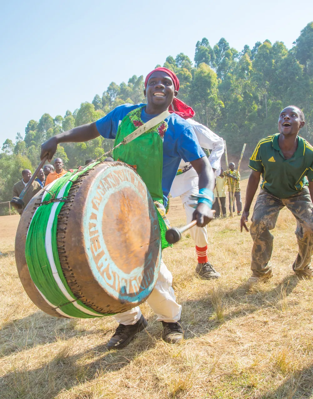
The region's peoples include the Ngoni, the Matengo of the western highlands, the Yao, the Nyasa along the lake, and the Ndendeule and Ngindo to the north. Songea's public culture — drummed dances such as mganda, a strong church calendar, and the annual commemoration of the 1906 hangings — comes out of that mixture.
West of Mbinga the land falls to Lake Nyasa. Mbamba Bay, in Nyasa District, is the region's port: a small town with a sand beach, clear water and a handful of guesthouses, connected by lake ferry up the Tanzanian shore. It is one of the least-visited beautiful places in the country.
North of Songea, the wild country of Nyerere National Park — the largest national park in Tanzania — reaches down into Namtumbo District, and the Selous ecosystem's southern boundary runs through the region.
Towns, parks and places across Ruvuma Region
Town
Songea
The regional capital, the Maji Maji memorial museum and the heroes' graves.
Highlands
Mbinga and the Matengo highlands
Coffee country west of Songea, terraced with the pit-cultivated ngolo system.
Lakeshore
Mbamba Bay
The region's Lake Nyasa port, in Nyasa District: sand, clear water and very few visitors.
Monastery
Peramiho
The Benedictine abbey founded in 1898 outside Songea, with a large hospital and schools.
Town & district
Tunduru
The hot eastern district on the road to Mtwara — cashew country, and gemstone diggings.
National park
Nyerere National Park
The southern reaches of Tanzania's largest national park extend into Namtumbo District.
Informational — none of this is ticketed by us
National museum
Maji Maji War Memorial Museum, Songea
Photographs of the leaders hanged in 1906, the mass grave behind it, and the national account of the war.
Farming landscape
The Matengo pit farms
Hillsides dug into grids of pits around Mbinga — a farming system studied worldwide.
Lakeshore
Mbamba Bay
Lake Nyasa at the end of a long road west from Mbinga. Swimming, fishing boats and quiet.
Monastery
Peramiho Abbey
A working Benedictine abbey since 1898, with one of the south's major hospitals.
Living culture
Mganda and the dance season
Drummed dance at celebrations through the year. Ask locally rather than expecting a performance.
National park
Nyerere National Park, Namtumbo
The park's remote southern edge. Access is easier from the north, but the country here is genuinely wild.
Before you go
- Getting there
- Air Tanzania flies Dar es Salaam–Songea several times a week. By road, the paved route runs from Makambako in the north and east towards Tunduru and Mtwara.
- Getting around
- A vehicle and driver. Mbinga is a few hours west of Songea, and Mbamba Bay a rough descent beyond it.
- When to come
- May to October is dry. The rains, roughly November to April, make the lake road hard going.
- The memorial
- The graves are a place of mourning for local families. Dress modestly and ask before photographing people.
- Borders
- Mozambique lies across the Ruvuma River to the south. Carry your passport when travelling near the border.
- Money
- Shillings. ATMs in Songea and Mbinga; carry cash for the lake.
Last reviewed 2026-09-17
Editorial — fact-check complete
Checked against
- 2022 Population and Housing Census — administrative unitsNational Bureau of Statistics, Tanzania
- Ruvuma Region — area, districts, peoples, economyWikipedia
- Majimaji War Memorial MuseumNational Museum of Tanzania
- Intensive cultivation and environment use among the MatengoAfrican Study Monographs, Kyoto University
- Ngaka coal mine — operation and outputGlobal Energy Monitor
- Peramiho Abbey — historyMissionary Benedictines, Peramiho