Mtwara
A port built from scratch for a failed colonial farming scheme, beside the old Swahili town where Livingstone began his last journey — the capital of cashew country, Makonde carving, and a marine park on the Mozambique border.
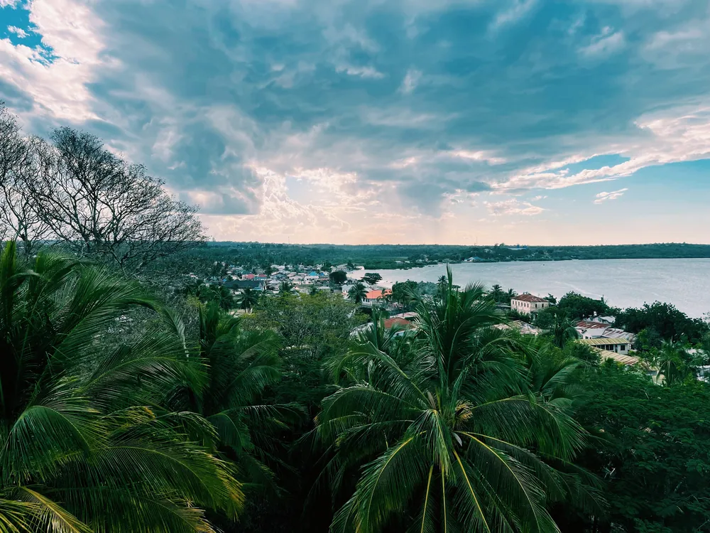
Mikindani Bay from the hill above Mtonya. The old Swahili town lies about ten kilometres west of the modern port.
- Region
- Mtwara Region, far south-east coast
- Population
- 146,772, Mtwara Municipal (2022 census)
- Region total
- 1.63 million people (2022 census)
- Port
- Deep-water, built in the late 1940s
- Border
- Mozambique, across the Ruvuma River
Livingstone's last departure, and a port for peanuts
The older town is Mikindani, on its sheltered bay just west of the modern town. It was a Swahili trading port whose nineteenth-century business was ivory, gum copal and enslaved people for the plantations of the Indian Ocean. In April 1866, after failing to enter the Ruvuma estuary, David Livingstone landed at Mikindani Bay and set off inland on the expedition from which he never returned.
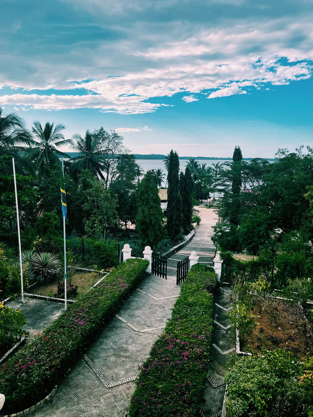
Under German rule, around 1895, the colonial administration built a fortified administrative boma above the town. It fell into ruin, and since 1997 it has been restored and run by a development charity as a vocational training centre.
Mtwara itself is a mid-twentieth-century invention. In 1946 the British government launched the Tanganyika groundnut scheme, a vast plan to mechanise peanut farming for Britain's post-war food supply. To serve its southern farms it built a deep-water port at Mtwara from nothing, and a railway inland. The scheme failed and was abandoned in 1951; the railway, which never had anything to carry, was dismantled. The port stayed, and in 1952 the administration of the south moved here from Lindi.
Cashew, gas and the port
What the region lives on
- Cashew
- The country's leading producing region
- Natural gas
- Mnazi Bay, piped to Dar es Salaam
- Port
- Cargo including cashew and cement
- Cement
- A large plant outside the town
- Fishing
- Along the whole coast
The land handed back after the groundnut scheme went, among other things, to cashew, and cashew now defines the south. Mtwara is Tanzania's leading cashew-producing region, ahead of neighbouring Lindi, and in a good season the crop is worth hundreds of billions of shillings to its farmers. Most is exported as raw nut.
Beneath the sea lies the second pillar. Natural gas was discovered at Mnazi Bay in 1982 and brought into production in 2006. A 542-kilometre pipeline to Dar es Salaam, with a processing plant at Madimba, was commissioned in 2015 to carry southern gas to the power stations and industry of the capital.
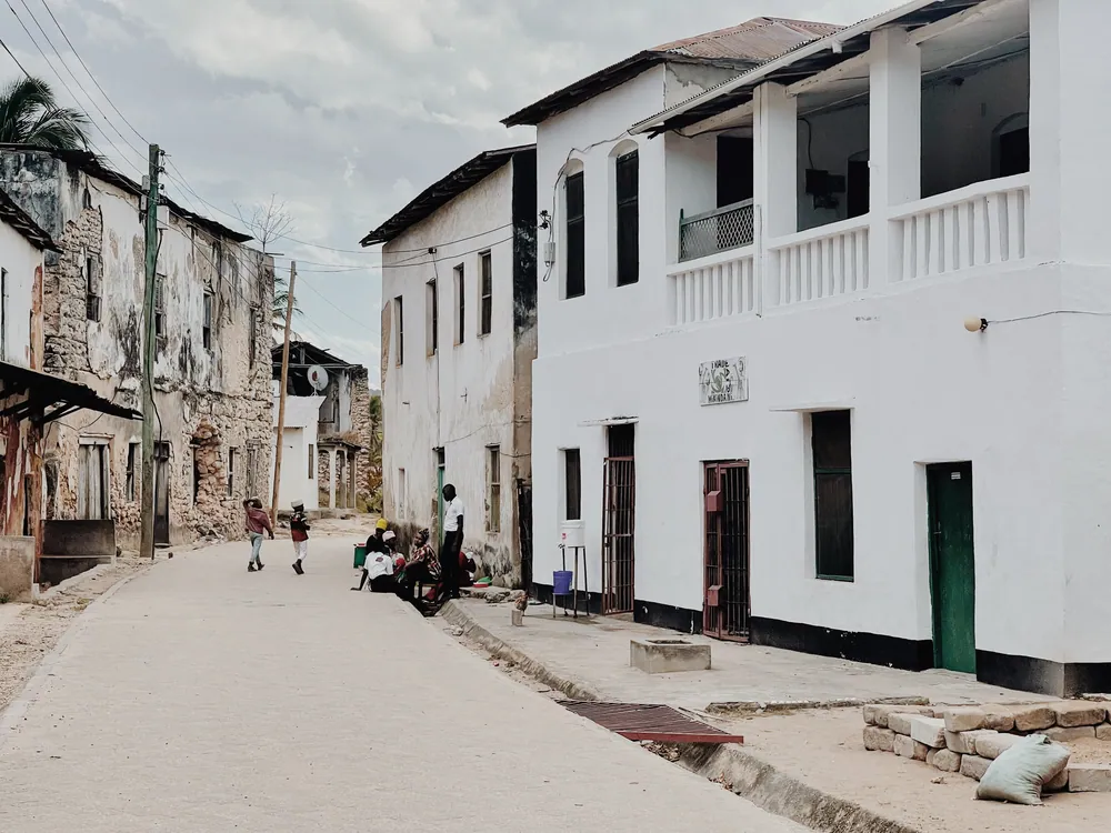
The port has been upgraded to take container ships, and a large cement plant operates outside the town. For all that, Mtwara still feels like a quiet, wide-streeted coastal town built for a population it never quite reached.
The Makonde plateau, and a coast that runs to Mozambique
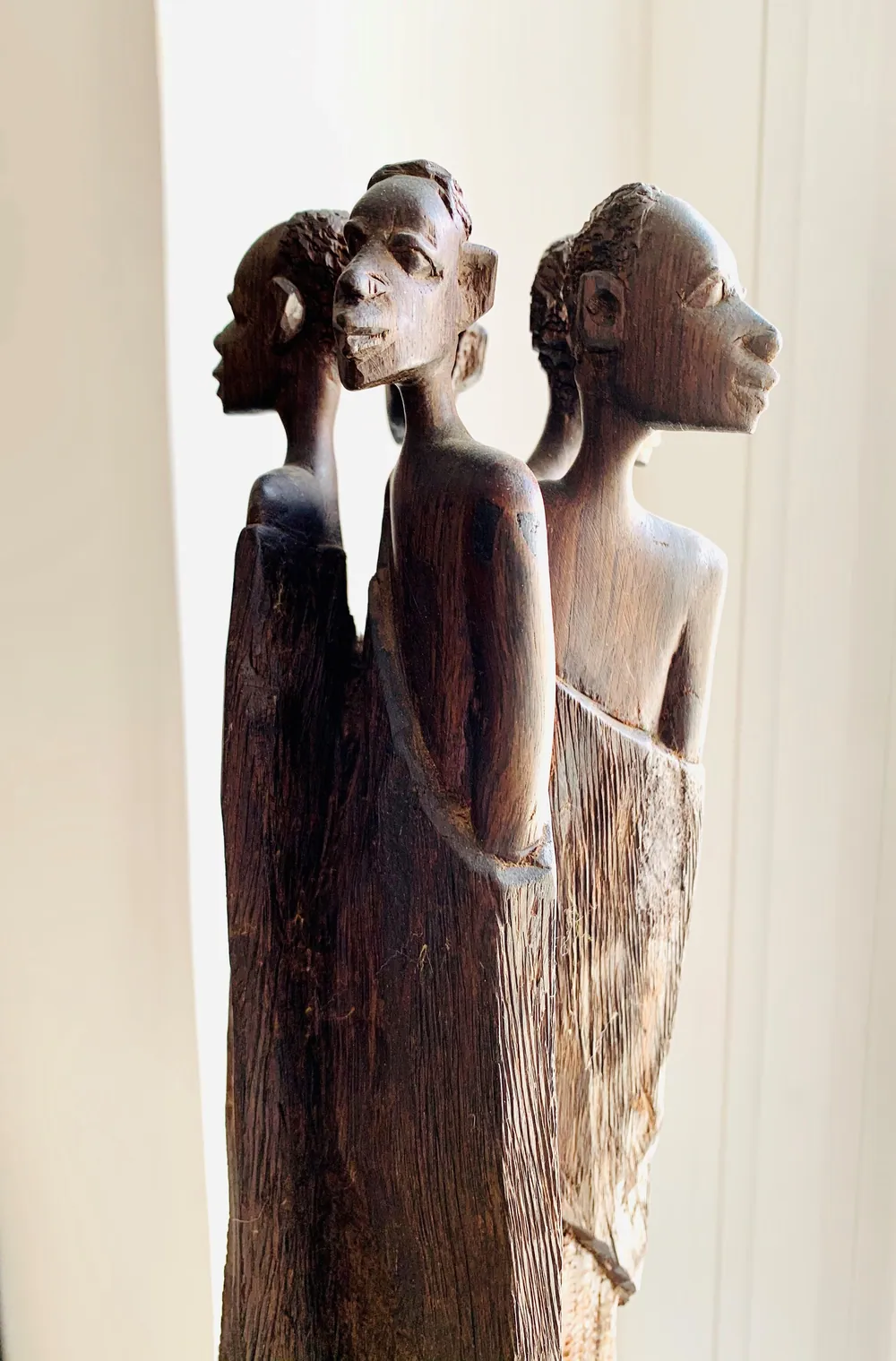
Inland rises the Makonde plateau, home of the Makonde, a matrilineal people who live on both sides of the border with Mozambique. They are famous for wood carving, much of it in African blackwood, or mpingo. Two styles are best known: ujamaa, towers of interlocked figures representing a family or community, and shetani, distorted spirit figures drawn from Makonde belief. At Newala, on the plateau's edge, the viewpoint called Shimo la Mungu — God's Hollow — looks out over the Ruvuma valley into Mozambique.
South of the town, the coast from Mnazi Bay to the Ruvuma estuary is protected as the Mnazi Bay–Ruvuma Estuary Marine Park, established in 2000. It covers about 650 km² of mangroves, coral reef, seagrass and beach, where green and hawksbill turtles nest and humpback whales pass. Around 30,000 people live inside it, fishing as they always have.
The Ruvuma itself was bridged only in 2010, when the Unity Bridge opened at Mtambaswala — 720 metres long, and the first road link across the river between the two countries. Mtwara is, in every sense, the end of the Tanzanian coast.
Towns, parks and places across Mtwara Region
Town
Masasi
The main inland town, about 210 km west of Mtwara on the road towards Songea.
Heritage site
Ndanda Abbey
A Benedictine abbey founded in 1906 in Masasi District, with a referral hospital that serves much of the south.
Village & beach
Msimbati
A fishing village and beach inside the Mnazi Bay–Ruvuma Estuary Marine Park.
Border crossing
Mtambaswala and the Unity Bridge
The 720-metre bridge over the Ruvuma to Mozambique, opened in 2010.
Informational — none of this is ticketed by us
Historic town
Mikindani old town
A Swahili port of coral-stone houses and carved doors on a sheltered bay, where Livingstone landed in 1866.
Colonial building
The Old Boma, Mikindani
The German administrative fort of about 1895, restored and looking out over the bay.
Marine park
Mnazi Bay–Ruvuma Estuary Marine Park
Reefs, mangroves and turtle-nesting beaches down to the Mozambique border. Established 2000.
Coast
Mikindani Bay
The view that drew traders for centuries — best from the hill above the town in late light.
Viewpoint
Shimo la Mungu, Newala
God's Hollow, on the edge of the Makonde plateau, with views across the Ruvuma valley.
Craft tradition
Makonde carving
Blackwood sculpture in the ujamaa and shetani styles. Buy from workshops, and ask how the wood was sourced.
Before you go
- Getting there
- Daily flights from Dar es Salaam to Mtwara Airport. By road the paved coastal route runs south from Dar through Lindi — a long day's drive.
- Getting around
- Mikindani is about 10 km from town. The marine park and Newala need a vehicle and driver.
- When to come
- June to October is dry, with calmer sea. The rains run roughly November to April.
- Marine park
- An entry fee is charged by the Marine Parks and Reserves Unit. Go with a local guide for snorkelling and turtle beaches.
- Respect
- A conservative, largely Muslim coast. Cover shoulders and knees away from the beach, and ask before photographing people.
- Money
- Shillings. ATMs in Mtwara; carry cash for Mikindani, Newala and the park.
Last reviewed 2026-09-15
Editorial — fact-check complete
Checked against
- 2022 Population and Housing Census — administrative unitsNational Bureau of Statistics, Tanzania
- Mnazi Bay–Ruvuma Estuary Marine ParkMarine Parks and Reserves Unit, Tanzania
- New bridge links Mozambique and Tanzania — Unity BridgeTanzania High Commission, Maputo
- Tanzania natural gas — Mnazi Bay and the pipelineEmbassy of Tanzania, Ankara
- Cashew farmers earn Sh1.3tr as production heads toward recordThe Citizen
- Tanganyika groundnut scheme — Mtwara port, railway, abandonmentWikipedia
- Livingstone, David — landing at Mikindani, 1866Dictionary of National Biography (Wikisource)
- Mikindani — trade, the German bomaWikipedia
- Ndanda AbbeyWikipedia
- Masasi DistrictWikipedia