Morogoro
An agricultural town at the foot of the Uluguru Mountains, two to three hours inland from Dar es Salaam — the gateway to Mikumi and Udzungwa, and a base for some of the best forest walking in the country.
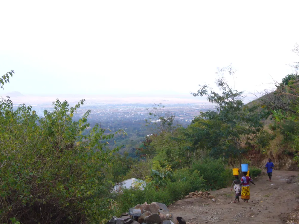
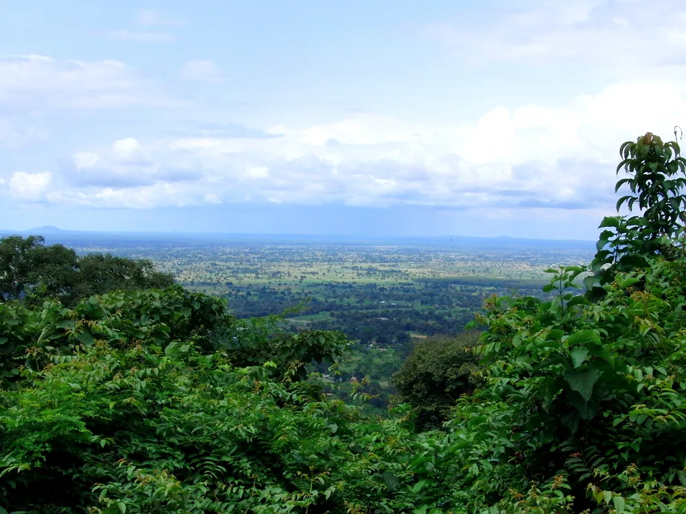
Morogoro and its plain from the Uluguru slopes. The mountains rise directly behind the town.
- Region
- Morogoro Region, eastern Tanzania
- Region population
- 3,197,104 (2022 census)
- Mountains
- The Uluguru, part of the Eastern Arc
- Known for
- Agriculture, and Sokoine University
- Gateway to
- Mikumi and Udzungwa national parks
A town on the caravan road and the railway
Morogoro sits where the plains meet the Uluguru Mountains, and that position has always mattered. The nineteenth-century caravan routes from the coast to the interior passed nearby, and the mountains, with their reliable water and fertile slopes, supported dense farming communities long before any colonial station was built.
The Luguru people of the mountains are known for a matrilineal social system, in which land and clan identity pass through the female line — a distinctive feature among the peoples of Tanzania.
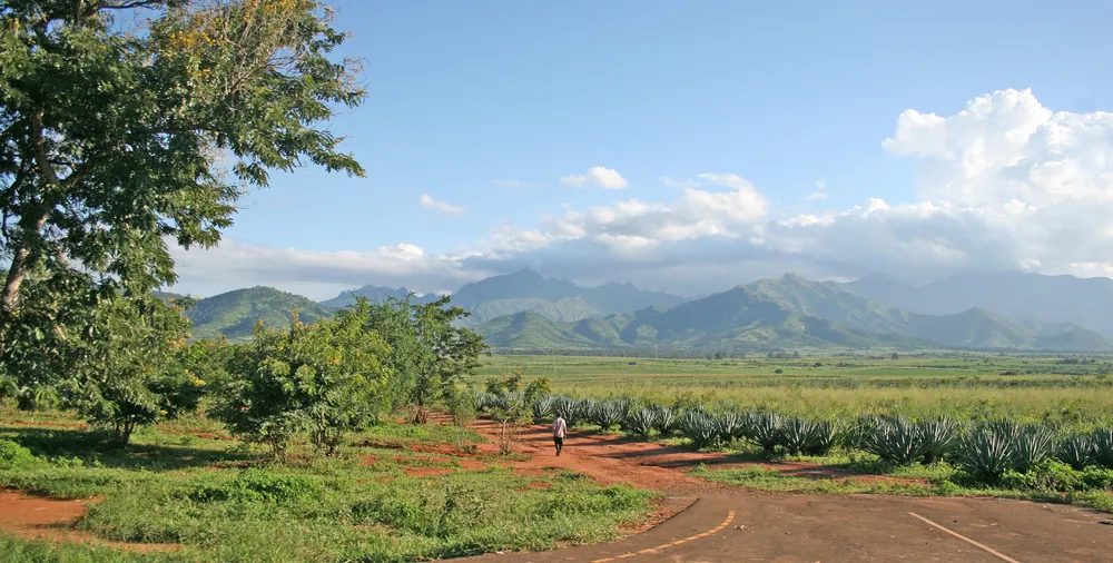
Under German and then British rule, Morogoro became a station on the Central Railway and a centre for the plantation economy, especially sisal, which spread across the plains around the town. After independence it grew as an agricultural and educational centre, and today it is home to Sokoine University of Agriculture, one of the country's leading universities for farming and veterinary science.
The farming heart of the east
What the region produces
- Sisal
- Estates on the plains
- Sugar
- Large estates in the Kilombero valley
- Rice
- Kilombero is a major rice-growing area
- Vegetables & fruit
- From the Uluguru slopes to Dar markets
- Education
- Sokoine University of Agriculture
Morogoro Region is one of Tanzania's most important agricultural areas. Sisal estates spread across the plains, and to the south the Kilombero valley is a major centre for sugar and rice.
The Uluguru slopes grow vegetables and fruit that supply Dar es Salaam, a short journey away. Being so close to the capital's markets gives local farmers an advantage few regions have.
The university adds a steady research and student economy, and the town's position on the main highway and railway west makes it a busy stopping point for traffic heading into the interior and south towards Mikumi.
Mountain forest on the doorstep
The Luguru culture of the mountains remains strong, with its matrilineal clans and a close relationship to the land. On the slopes, small villages and terraced farms sit among the forest, and walking between them is the best way to understand the region.
The Uluguru Mountains are part of the Eastern Arc, the ancient chain that includes the Usambara and Udzungwa ranges. Their isolated forests hold plants and animals found nowhere else, including the Uluguru bush-shrike, one of Africa's rarest birds. Guided walks from town lead to waterfalls, viewpoints and villages.
For most visitors, Morogoro is a stop on the way to Mikumi National Park, about two hours west, or the Udzungwa Mountains further south. But it rewards a night: the air is fresher than the coast, the mountains are close, and the walking is excellent.
Towns, parks and places across Morogoro Region
Town
Kilosa
Founded as a German fort in 1891; a junction on the old Central Line and now a station on the standard-gauge railway.
Town
Mahenge
Headquarters of Ulanga District in the Mahenge Mountains, and the scene of a major attack on the German post in August 1905, during the Maji Maji war.
Town
Ifakara
The main town of the Kilombero valley, one of the country's great rice-growing areas.
National park
Nyerere National Park
The country's largest national park reaches into the south-east of the region.
Informational — none of this is ticketed by us
Mountains
Uluguru Mountains
Eastern Arc forest, waterfalls and village walks, starting right behind the town. Go with a local guide.
National park
Mikumi National Park
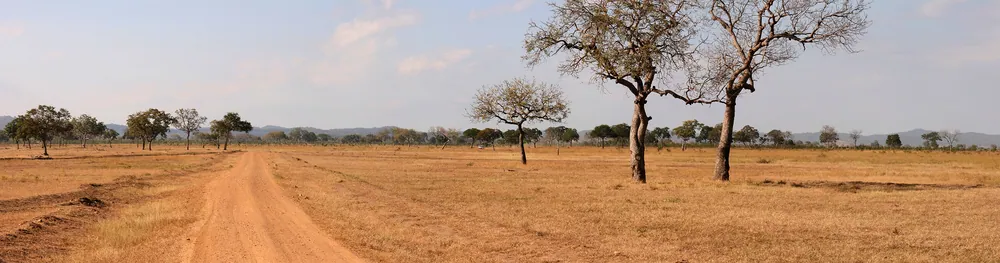
About two hours west on the main highway — the most accessible big park from Dar es Salaam.
National park
Udzungwa Mountains National Park
South through the Kilombero valley — rainforest, the Sanje Falls and primates found nowhere else.
Walking
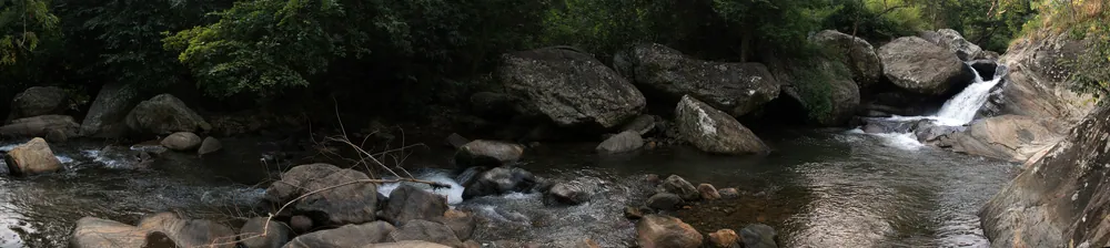
Uluguru waterfalls
Forest streams and falls on the lower slopes, reachable on a half-day walk.
Farmland & wetland
Kilombero valley
A vast green valley of rice and sugar, and an important wetland for birds.
Market
Morogoro market
Fresh produce from the mountains and plains, and a good picture of the region's farming.
Before you go
- Getting there
- Around two to three hours from Dar es Salaam by road, and on the standard-gauge railway line west from Dar.
- Getting around
- Taxis and bajaji in town. Take a local guide for any walking in the Uluguru.
- When to come
- June to October is driest. The mountains are wettest from March to May.
- Walking
- Trails are steep and not signposted. Book a guide in town — it also supports the mountain villages.
- Money
- Shillings. ATMs in town; carry cash for the mountains.
- Time
- East Africa Time, UTC+3, no daylight saving.
Last reviewed 2026-09-15
Editorial — fact-check complete
Checked against
- 2022 Population and Housing Census resultsNational Bureau of Statistics, Tanzania
- Uluguru Mountains — Eastern Arc forestsWikipedia
- Mikumi National ParkTanzania National Parks (TANAPA)
- Sokoine University of AgricultureSokoine University of Agriculture
- Kilosa — founding and railwayWikipedia
- Mahenge — Maji Maji attack of 1905Wikipedia