Katavi
Miombo, floodplain and the eastern shore of Lake Tanganyika — a region of 45,000 square kilometres with one of Africa's least visited great parks in the middle of it, and a fortified mission of 1893 standing on the lake.
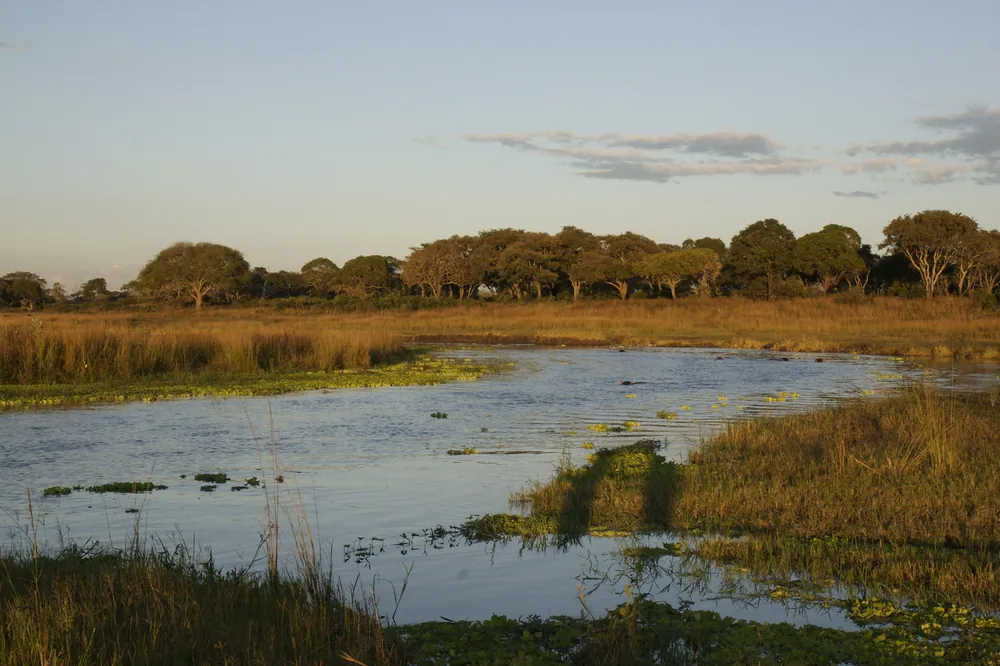
The Katuma floodplain in Katavi National Park. In the dry season the game concentrates here in numbers few parks can match.
- Region
- Katavi Region, far west
- Population
- 1,152,958 (2022 census)
- Area
- 45,843 km²
- Created
- 2012, from Rukwa Region
- Capital
- Mpanda
Fort Leopold, and the mission that replaced it
The region takes its name from Katavi, a spirit associated with the lake and with the floodplain that became the national park.
Its most unexpected history is at Karema, on the shore of Lake Tanganyika. In 1879 an expedition working for King Leopold II of the Belgians occupied the site and called it Fort Leopold — an outpost of an ambition that reached this far east before the Berlin Conference assigned the eastern lake shore to Germany. Leopold then invited the White Fathers to take it over, and from 1885 the missionaries built a village there with five hundred people freed from slave caravans. Their church went up in 1890 and a fortified mission house in 1893, which is still standing.
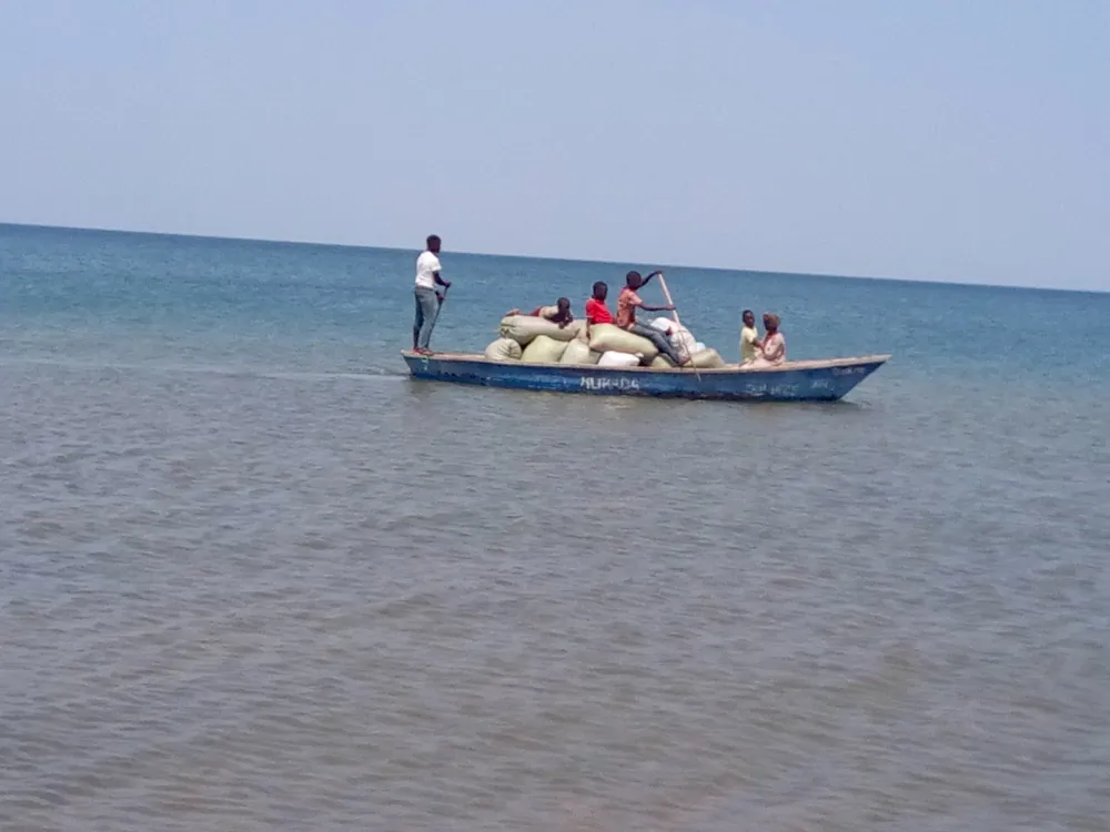
Lake traffic tied the shore together long before roads did. The MV Liemba — launched in 1913 as the German Graf von Götzen, scuttled, raised and relaunched in 1927 — called at Karema and the other lake ports for decades. She has been out of service since 2018 and, after a major refit, is due back on the lake from September 2026.
Katavi Region itself was created in 2012, when Mpanda District was separated from Rukwa.
Farming in the miombo
What the region lives on
- Maize & rice
- The main crops of the region
- Sunflower & cassava
- Grown widely alongside them
- Fishing
- Lake Tanganyika and Lake Rukwa
- Honey
- From the miombo woodland
- Gold
- Small-scale mining in the district
Almost everyone here farms. Agriculture accounts for the overwhelming share of the regional economy, and the staple crops are maize, rice, sunflower and cassava, grown in clearings cut out of the woodland.
That woodland is the defining feature of the region: miombo covers something close to seven-tenths of Katavi's land area. It supports beekeeping — honey is a real cash earner here, as it is in Tabora — and it is the reason so much of the region is protected as park, game reserve or forest reserve.
Fishing works both edges of the region: Lake Tanganyika in the west, and the northern end of Lake Rukwa in the south-east. Small-scale gold mining adds cash in places, and Mpanda is the market town where all of it is traded.
A region with very few visitors
The region's peoples include the Pimbwe, Bende, Konongo, Tongwe, Vinza and Holoholo, with Fipa and others alongside them. These are small communities in a very large space, farming and fishing, and the region has never had the roads or the towns to concentrate them.
Mpanda, the capital, is a working town at the end of a branch of the Central Line railway — for years the main way in. Roads have improved a great deal in the last decade, and the drive north to Kigoma or south to Sumbawanga is now feasible in a day in the dry season.
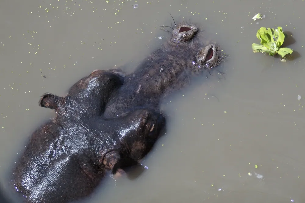
The reason to make the journey is Katavi National Park. At 4,471 km² it is one of the largest parks in the country, and in the late dry season the shrinking Katuma river and the floodplains hold concentrations of hippo, buffalo and crocodile that are hard to believe if you have only seen the northern circuit. It receives a tiny fraction of the Serengeti's visitors — which is its whole character.
Towns, parks and places across Katavi Region
National park
Katavi National Park
4,471 km² of floodplain and miombo, gazetted in 1974 — one of the emptiest great parks in Africa.
Lakeshore village
Karema
A fishing village on Lake Tanganyika with a fortified White Fathers mission house of 1893 still standing.
Town
Mpanda
The regional capital and railhead, and the base for reaching the park and the lake.
Rift lake
Lake Rukwa
The northern end of the shallow, shifting soda lake reaches into the region's south-east.
Game reserve
Rukwa Game Reserve
Protected miombo adjoining the park — remote, and with almost no infrastructure.
Informational — none of this is ticketed by us
National park
Katavi National Park
Hippo and buffalo on the Katuma floodplain in the late dry season, and almost no other vehicles.
Heritage
The Karema mission
The 1893 fortified mission house above the lake, and the village founded with people freed from the slave caravans.
Lakeshore
Lake Tanganyika shore
Clear water, fishing villages and the old steamer ports on the world's second-deepest lake.
Town
Mpanda
Railhead, market and supply town — where to stock up before the park.
Woodland
The miombo
Dry woodland across most of the region, with beekeeping in the trees and elephants moving through it.
Rift lake
Lake Rukwa's northern shore
Birds, fishing camps and a lake whose size changes from decade to decade.
Before you go
- Getting there
- Light aircraft serve the park's airstrips in season. By road, Mpanda is reached from Sumbawanga, Kigoma or Tabora; trains run on the Central Line branch to Mpanda.
- Getting around
- A 4x4 and a driver, and fuel planned in advance. Distances are long and services few.
- When to come
- August to October is the spectacle in Katavi, when the water has gone and the game concentrates. The rains, roughly December to April, make roads hard.
- Park fees
- Katavi is a TANAPA park; fees are paid at the gate, and driving inside is restricted to daylight hours.
- Self-sufficiency
- There is very little accommodation outside a handful of camps. Book ahead and carry water, cash and spares.
- Money
- Shillings, in cash. Do not rely on card payment anywhere in the region.
Last reviewed 2026-09-17
Editorial — fact-check complete
Checked against
- 2022 Population and Housing Census — administrative unitsNational Bureau of Statistics, Tanzania
- Katavi Region — creation, area, peoples, miombo, economyWikipedia
- Karema — Fort Leopold, the White Fathers, the 1893 mission houseWikipedia
- Katavi National ParkTanzania National Parks (TANAPA)
- MV Liemba restoration and return to serviceThe Citizen